Visit to Uluru (aka Ayers Rock)
OK, so for the first real entry in my blog, I'll take you back to a trip I took in August to visit Uluru. For those of you who are unfamiliar with Australia, first a quick geography review...
Alice springs is located almost exactly in the center of Australia:

Uluru is 443km (275 miles) south west of Alice Springs, along the Stuart and Lasseter Highways. It takes 4-5 hours to drive from Alice Springs to Uluru:

And those are desolate miles...best comparison I can make is driving through the high desert country of Arizona. If you are interested in more information about the "Red Centre," click here. There are only a few places to stop on the way and even fewer places to get gas. It pays to be prepared when traveling in the Outback.
So back to the trip...
A friend of mine (hi Melissa!) was visiting Alice Springs on business for a few weeks and asked if I would driver her out to see "the rock." Having only been out there once before (and with dogs that are not allowed in the park) I quickly volunteered. Brian (a coworker of Melissa's) came along. So I agreed to pick them both up early on a Saturday morning. I had originally wanted to get an extremely early start in the hopes of getting to Uluru in time for sunrise, but the thought of driving several hours in darkness and trying to avoid kangaroos on the road encouraged a later start.
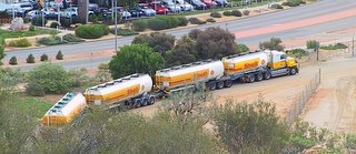 One of the interesting sites (and challenges) of driving in Australia, aside from driving on the left side of the road, are the frequent "road trains" that you see driving on the Stuart Highway. Here's an example of a typical road train.
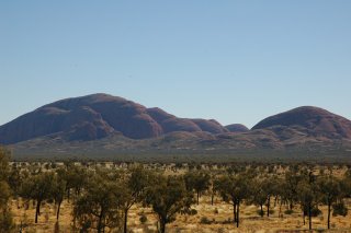
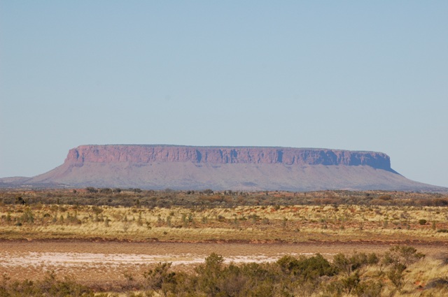
Now, part of the fun of getting to Uluru is passing Mt. Connor. Most of you recognize the image of Uluru even if you don't immediately recognize the name. So as we were driving along, this formation came into view:
 Never having been here before, I naturally thought, "There's Ayers Rock!" So we stopped, took some pictures, and kept on driving. Suddenly the road turned away from Ayers Rock and we kept getting further away. At this point, I was getting concerned that I might be on the wrong road. Getting lost in the Outback is NOT something I was interested in, but knowing I was on a reasonably well-traveled highway, I decided to press on. As it turned out, what I thought was Uluru was really Mt. Connor, a 700 million year old sand and rock table top mountain, or mesa which is located directly west of Uluru. It would have been nice if there had been a sign at the rest stop overlooking Mt Connor!
As with most rural highways, we saw our fair share of "road kill" on the trip. Of course, the difference in Australia is that you see kangaroos, horses, cows and camels by the side of the road instead of deer! There are large areas of open range in the center of Australia where vast cattle ranches sprawl across the landscape. Most of the places to stop and get gas/food, etc. are actually cattle stations that periodically process the cattle for shipment to slaughterhouses.
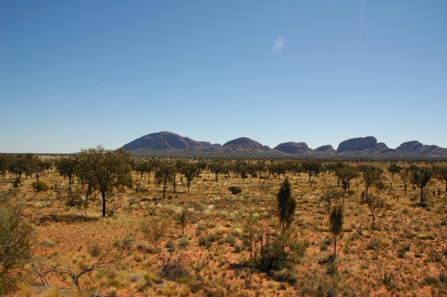
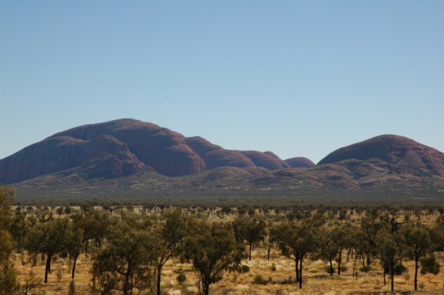
By the time we drove into Ayers Rock Resort, is was about 1100. By this time, despite bringing along water, snacks, fruit, etc. in a cooler, we stopped to get a bite to eat. Now we had to make a decision, since we wanted to get back before midnight. Just up the road from the resort, the road splits and you have a choice of visiting either the Olgas (another rock formation about 45 kilometers away) or Uluru. Knowing that we intended to climb Uluru, we opted to visit the Olgas briefly and then continue on to Uluru.
Here are some pictures of the Olgas from a distance a few close up:


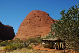

Most of the rock formations in the Kata Tjuta National Park have religious significance to the Aboriginals. Click here to learn more.
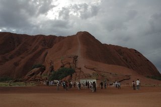
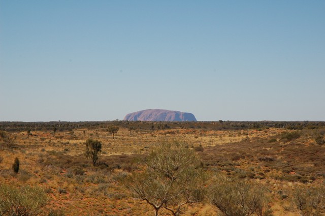
And then, off in the distance we spotted...

Uluru.
Tourists are discouraged from actually climbing Uluru, despite the fact that there is a chain installed on the rock to assist climbers the first third of the way. Click here to find out why. Having traveled all this distance, of course we decided to climb. Here are some pictures:
 A little bit of the parking lot and the entrance.
 Here you can see the chain that goes up the steepest section of the climb. Every year at least a few tourists are injured trying to climb this in the heat of summer!
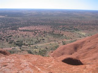 A view from the top...

And a beautiful sunrise shot (not my own...)
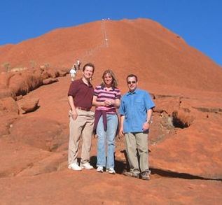
Here are the three of us (after the climb) courtesy of a nice Australian couple who gave us company and water during the climb!

By the time we were on our way down (it takes a good hour to climb up and about 45 minutes back down) there was a bus load of Japanese tourists just beginning the climb. Some of those tourists should NOT have been trying to climb! A few of them turned around about half way up the chained path...good for them since I don't think they would have made it if they tried to continue!
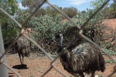
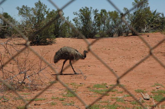
A quick snack from the cooler and we were on our way back to Alice Springs. Here are some pictures of the "petting zoos" (there are at least two) along the way:

And we rolled back into Alice Springs around 1000 p.m. that evening. Total road time...16 hours...and boy did we feel it!
That's it for this entry.
Alice springs is located almost exactly in the center of Australia:

Uluru is 443km (275 miles) south west of Alice Springs, along the Stuart and Lasseter Highways. It takes 4-5 hours to drive from Alice Springs to Uluru:

And those are desolate miles...best comparison I can make is driving through the high desert country of Arizona. If you are interested in more information about the "Red Centre," click here. There are only a few places to stop on the way and even fewer places to get gas. It pays to be prepared when traveling in the Outback.
So back to the trip...
A friend of mine (hi Melissa!) was visiting Alice Springs on business for a few weeks and asked if I would driver her out to see "the rock." Having only been out there once before (and with dogs that are not allowed in the park) I quickly volunteered. Brian (a coworker of Melissa's) came along. So I agreed to pick them both up early on a Saturday morning. I had originally wanted to get an extremely early start in the hopes of getting to Uluru in time for sunrise, but the thought of driving several hours in darkness and trying to avoid kangaroos on the road encouraged a later start.
 One of the interesting sites (and challenges) of driving in Australia, aside from driving on the left side of the road, are the frequent "road trains" that you see driving on the Stuart Highway. Here's an example of a typical road train.
Now, part of the fun of getting to Uluru is passing Mt. Connor. Most of you recognize the image of Uluru even if you don't immediately recognize the name. So as we were driving along, this formation came into view:
 Never having been here before, I naturally thought, "There's Ayers Rock!" So we stopped, took some pictures, and kept on driving. Suddenly the road turned away from Ayers Rock and we kept getting further away. At this point, I was getting concerned that I might be on the wrong road. Getting lost in the Outback is NOT something I was interested in, but knowing I was on a reasonably well-traveled highway, I decided to press on. As it turned out, what I thought was Uluru was really Mt. Connor, a 700 million year old sand and rock table top mountain, or mesa which is located directly west of Uluru. It would have been nice if there had been a sign at the rest stop overlooking Mt Connor!
As with most rural highways, we saw our fair share of "road kill" on the trip. Of course, the difference in Australia is that you see kangaroos, horses, cows and camels by the side of the road instead of deer! There are large areas of open range in the center of Australia where vast cattle ranches sprawl across the landscape. Most of the places to stop and get gas/food, etc. are actually cattle stations that periodically process the cattle for shipment to slaughterhouses.
By the time we drove into Ayers Rock Resort, is was about 1100. By this time, despite bringing along water, snacks, fruit, etc. in a cooler, we stopped to get a bite to eat. Now we had to make a decision, since we wanted to get back before midnight. Just up the road from the resort, the road splits and you have a choice of visiting either the Olgas (another rock formation about 45 kilometers away) or Uluru. Knowing that we intended to climb Uluru, we opted to visit the Olgas briefly and then continue on to Uluru.
Here are some pictures of the Olgas from a distance a few close up:


Most of the rock formations in the Kata Tjuta National Park have religious significance to the Aboriginals. Click here to learn more.
And then, off in the distance we spotted...
Uluru.
Tourists are discouraged from actually climbing Uluru, despite the fact that there is a chain installed on the rock to assist climbers the first third of the way. Click here to find out why. Having traveled all this distance, of course we decided to climb. Here are some pictures:
 A little bit of the parking lot and the entrance.
 Here you can see the chain that goes up the steepest section of the climb. Every year at least a few tourists are injured trying to climb this in the heat of summer!
 A view from the top...
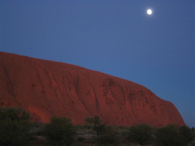
And a beautiful sunrise shot (not my own...)
Here are the three of us (after the climb) courtesy of a nice Australian couple who gave us company and water during the climb!
By the time we were on our way down (it takes a good hour to climb up and about 45 minutes back down) there was a bus load of Japanese tourists just beginning the climb. Some of those tourists should NOT have been trying to climb! A few of them turned around about half way up the chained path...good for them since I don't think they would have made it if they tried to continue!
A quick snack from the cooler and we were on our way back to Alice Springs. Here are some pictures of the "petting zoos" (there are at least two) along the way:


And we rolled back into Alice Springs around 1000 p.m. that evening. Total road time...16 hours...and boy did we feel it!
That's it for this entry.

Comments